The wind was from the south yet again today. This means that TOPWLH, on her regular Friday ride, got an opportunity to see the route that I have developed over the last few days to dodge around the Fair.
We ended up riding up Summit Avenue in Saint Paul. There are, if I calculate correctly, six institutions of higher learning who regularly correspond with us, sending us the odd alumni news bits and, perhaps needless to say, requesting that we send them money, money which they always refer to as a "donation". I believe that of our six regular correspondents that either I or TOPWLH graduated at some level from five of them. When these "friends" start talking about "donations" I always ask if perhaps there is still a balance due on the tuition as I am unable to grasp any other circumstance in which I would send them more money. Our other regular correspondent is GAC which is of course the alma mater of the child we used to have (TCWUTH). We participated in a small way in paying for the GAC experience but the truth is that the former child largely paid for that whole thing herself. She did such a good job that I am certain that all of the tuition has been paid (Way to go Wireless!!!).
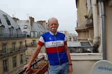
Here is a photo taken at Summit and Snelling, at a gateway to the campus where TOPWLH and I met.
 The sign to the right side indicates that the sign is a gift of the Class of 1952. On the one hand, good for the Class of 1952. On the other, see above, it makes me wonder if there was some problem with the tuition not having been paid in 1948 (fall), 49, 50, 51, and 52 (spring).
We eventually rode all the way to the Highland Golf Course, the furthest southern penetration that I have made recently to this part of Saint Paul. I have been farther south fairly regularly but only along the River Road. Today's ride brought us to the Highland Water Tower which is located on the highest point of elevation in the City of Saint Paul.
 I find it pretty interesting to look at the elevation of the Map My Ride profile. We rode to the highest point in the City of Saint Paul and that spot appears to be about 10 feet lower in elevation than the starting point which is relatively near to where I live.
Well, no wonder every one of those Map My Ride deals I post seems to be an outward downhill and a return uphill. It is starting to dawn on me that I live on one of the highest points in the metropolitan area. No wonder I see so many water towers on my rides.

5 comments:
And no wonder that now and then on the way home I mention that is seems to be uphill coming and going.
TOPWLH
PS Thanks TT for the pit stop today.
Still shorts weather in MN, I see.
I've always thought that the many lake ride was downhill on the way out, uphill on the way back, net/net. It is nice to be right.
See comment on Polar Bear post.
Including GAC, I can only think of 5 institutions of higher learning... Help?
Hmm. U of M, Mac, Hamline, GAC and Metro State?
TOPWLH
PS What IS up with the polar bear? That is NOT a polar bear in the previous post, as confirmed by GFR.
The Metrodome? See previous post, comment section.
Post a Comment